Sometimes the GPS signal is not reliable, due to varoius conditions including atmospheric interference, reflections off of terrain and building or satellite maintence. To keep the GPS signal consistent, various groups have come up with augmentation systems. There are two basic kinds of augmentation methods, satellite based and ground based.
The augmentation systems all basically operate the same way. The augmentation system has one or more GPS receivers at a known locations. The receivers calculate the position as best it can. The system then compares the calculated GPS position with the actual location. The difference from the actual position is broadcast to GPS receivers that are in the area, so they can compensate their calculated position the proper amount making the resolved location more accurate.
Satellite Based
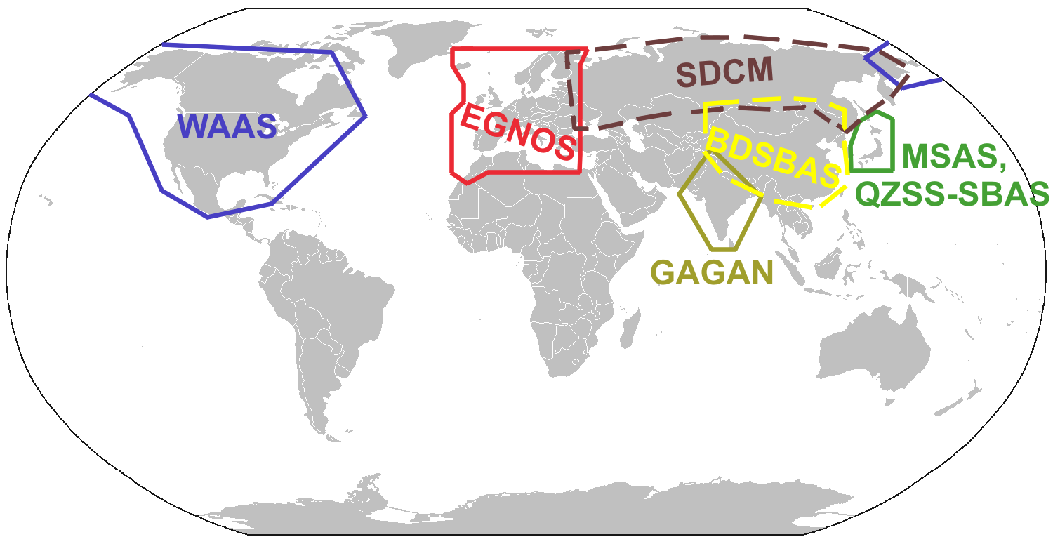
In the US, the satellite based augmentation system (SBAS) is called wide area augmentation system (WAAS). In Europe they have European Global Navigation Overlay Service (EGNOS). Wikipedia GNSS augmentation page has a great map that outlines the various systems proposed for the rest of the world:
The WAAS system uses several ground based stations at known locations throughout North America. The calculated difference is then broadcast to a master station that calculates the Deviation Correction (DC). The DC message is sent to the WAAS satellite. The DC signals are broadcast from the satellite to the appropriately equipped GPS receivers. The WAAS receivers are the ones certified to TSO-C145/C146 standard.
WAAS signals should allow the GPS receiver to resolve the position of the receiver to within 25ft vertically and horizontally 95% of the time. Usually the resolution is closer to 2ft. This accuracy will allow the the receiver to be used for precision approaches similar to the traditional ILS system.
Ground Based
There are two major types of ground based augmentation systems in the US, DGPS and LAAS. DGPS is differential GPS. DGPS users are normally survey crews, and boats. On boats, DGPS navigation is provided by the Coast Guard. Local area augmentation system (LAAS) is the FAA's version.
LAAS uses multiple (at least 4) receivers around an airport at known locations broadcasting correction signals in all directions. The LAAS correction signal will be broadcast on VHF navigation frequencies using a normal data link.
The advantage of LAAS over and ILS is that all the LAAS transmitters transmit on the same frequency. ILS will require a separate radio, antenna array and maintenance for each runway that the ILS is available for. The LAAS receiver
will calculate the approach path allowing for standard ILS like approaches. The accuracy should be better than WAAS since the difference is focused to a 30 mile diameter.
LAAS isn't not available at many airports today. The experimental LAAS installations have proven the system is quite useful. The system at Memphis has been proven safe since fall of 2006. The Memphis tests have been used for testing RNAV like approaches.
Approaches
GPS approaches are being added to many airport, almost daily. The typical GPS approach will not be as straight as and approach requiring VORs. Most aviation GPS receiver systems will be able to calculate the approach path waypoint to waypoint, where the waypoints are RNAV type locations.
Localizer Performance with Vertical guidance (LPV) is the highest precision approach level below RNP Special Aircraft and Aircrew Authorization Required (RNP SAAAR) approaches. LPV approaches are equivalent to ILS approaches. WAAS can provide adequate accuracy for LPV approaches. LAAS can also provide accuracy for LPV approaches.
The FAA is able to survey and publish LPV approaches at airports and runways without adding any extra equipment. Many runways that are not suitable for ILS equipment have LPV approaches today, and more are being surveyed all the time. The LPV is typically depicted on the GPS approach chart.
LNAV is a non-precision approach that can be accomplished with almost any GPS. Augmentation is not required for the LNAV approach provided the receiver is able to maintain resolution to 1800ft (0.3nm).LNAV approaches, are similar to VOR approaches for the minimum descent altitude (MDA). The LNAV is also typically depicted on the GPS approach chart.
Next up, we will talk about ADS/B and RNP and how they help keep us out of each others way.
No comments:
Post a Comment